Disputed border and territories
One of the least noticed results of Tibet’s invasion by the Chinese army in 1949 has been the permanent presence of Chinese military troops along the border with India – for the first time in history. Prior to this, India had little cause to maintain a military presence on its northern border. When the British arrived, they were not much more concerned, except of course to impose their military might over the Himalayan region including Nepal, Bhutan, Tibet and Sikkim. For the British, the main point was to facilitate trade with Tibet. This is why they accommodated Chinese suzerainty over Tibet, until the collapse of the Qing Dynasty in 1912. After this, they wished to keep Tibet as a buffer between India and China to counter the influence of Russia and to stop the expansionism of the new Republic of China.
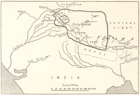
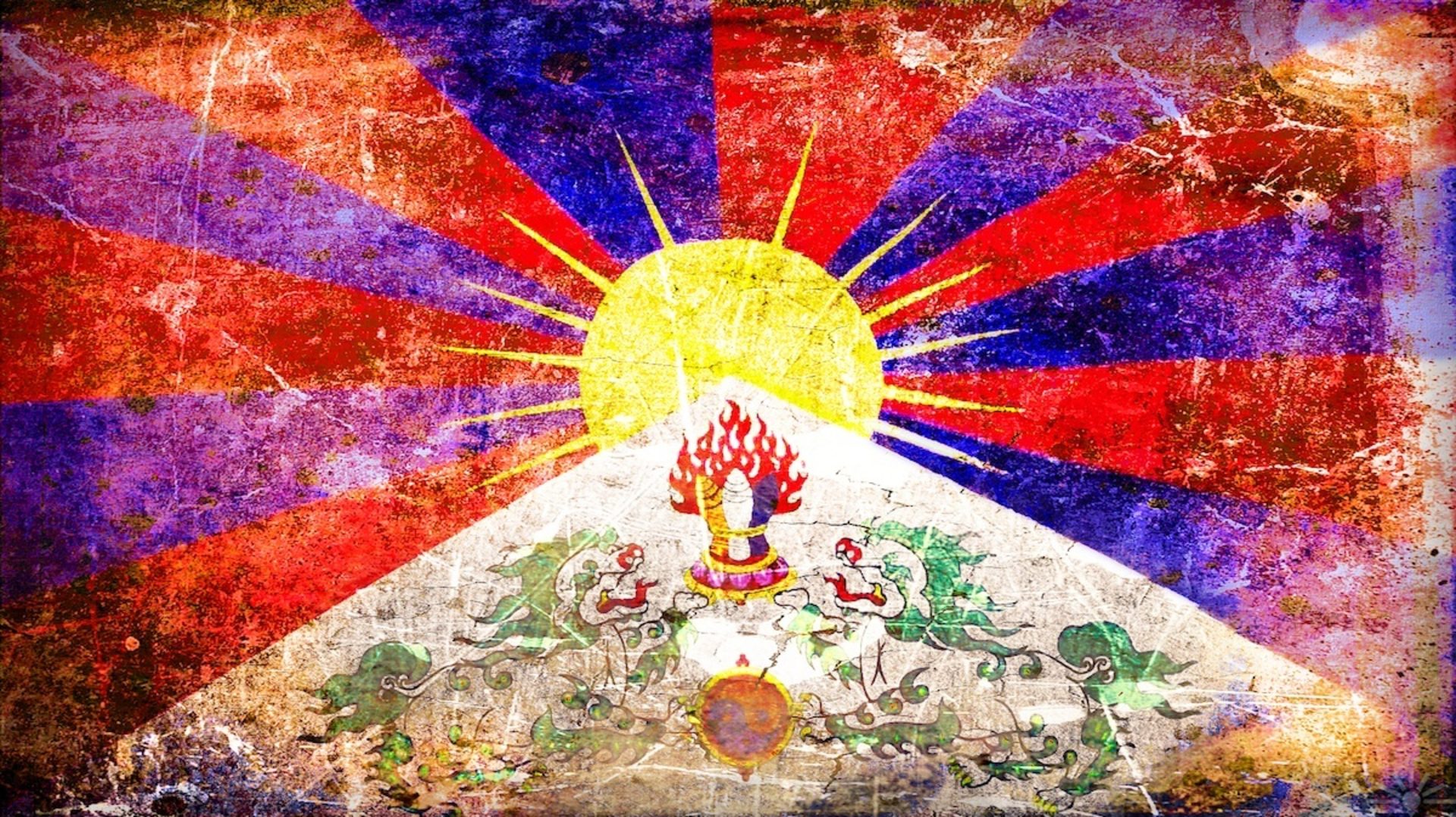
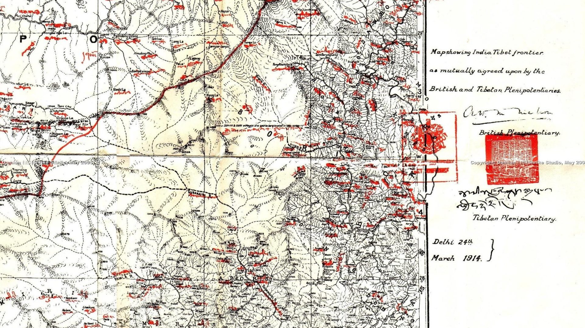
It was in this period that the 13th Dalai Lama (1876-1933) understood that he should proclaim the full independence of Tibet, based on its own military force, currency, postal system, flag, as well as its rich culture, language and religion. However one thing was missing for him: international recognition of Tibet’s borders. Because negotiations with the Chinese over the eastern border of Tibet had become impossible, he accepted that this task would fall to the British. As such, this is how the British, Tibetan and Chinese parties came to gather in Simla, leading to the drawing of the “McMahon line”, agreed upon only by the Tibetans and British. Why did the Chinese not sign? The fact that they did not come to the negotiation with their own maps prevented them from doing so, in contrast to the Tibetan party, which arrived with a full cache of maps.
Later, because of the death of the 13th Dalai Lama and the onset of the Second World War, the drawing of maps to be ratified could not be managed before 1947 or proposed to the Indian and Tibetan parties before India’s Independence. When Prime Minister Nehru asked the interim Tibetan government (between the 13th and 14th Dalai Lamas) to proceed with the ratification of the map, the incompetent Tibetan diplomats tried to reopen the negotiation in order to include Tawang, a region near the eastern Bhutanese border, as well as Sikkim. When Nehru explained to them that the time for negotiation had already concluded 35 years previously, they disdainfully declined to continue the process. Should they have ratified the map, it would have been considered a binding international treaty resulting in the international recognition of Tibet as an independent state. This historical blunder paved the way for the Mao’s new republic to invade Tibet two years later. The whole historical function of Tibet as a buffer came to its end, bringing for the first time in history permanent Chinese troops at the northern border of India.
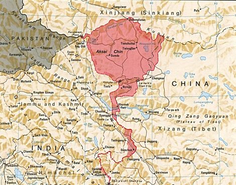
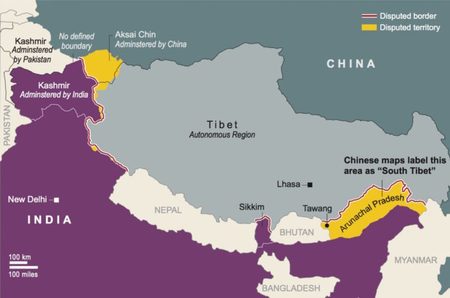
After 1950 all areas once ethnically connected with Tibet became, for Beijing, a part of the Chinese empire. Mao used the analogy of the palm of the hand (Tibet) and the five fingers (Bhutan, Sikkim, Arunachal Pradesh, Ladakh and Nepal). In 1962, the People’s Republic of China and India went to war over the disputed Himalayan border following the construction of military outposts in contested areas along the 3,225 km line, sectioned into three stretches by Nepal, Sikkim (then an independent kingdom), and Bhutan. A number of contentious regions lie along this border. At its western end is Aksai Chin, claimed by India and already occupied by China, a virtually uninhabited high-altitude wasteland crossed by the Xinjiang-Tibet Highway. The eastern border, between Burma and Bhutan, comprises the present Indian state of Arunachal Pradesh (formerly referred to as the North East Frontier Agency (NEFA)), claimed by China. The dispute concerns the sovereignty of these border regions, which were both overrun by China in the 1962 conflict.
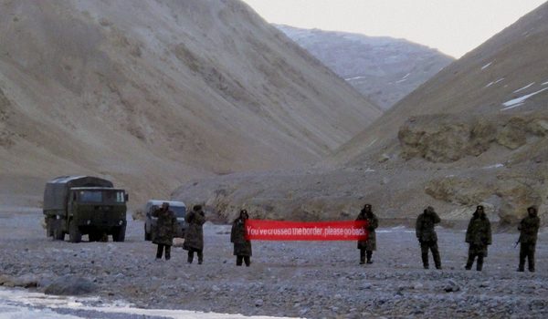
Two of the major factors leading up to the conflict were India’s stance on the disputed borders and perceived Indian subversion in Tibet. After the 1959 Tibetan uprising, when India had granted asylum to the Dalai Lama, there had been a series of violent border incidents. India placed outposts along the border, including several north of the McMahon Line, the eastern portion of a Line of Actual Control (LAC) proclaimed by Chinese Premier Zhou Enlai in 1959. China wished to end what was seen as India’s efforts to undermine Chinese control of Tibet and restore the pre-1949 status quo, as well as punishing Indian aggression along the border.
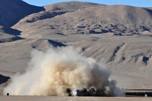
Unable to reach political accommodation on the disputed territory, the Chinese launched simultaneous offensives in Ladakh and across the McMahon Line on 20 October 1962. Chinese troops advanced over Indian forces in both theatres, capturing Rezang La in Chushul in the western theatre, as well as Tawang in the eastern theatre. This one month long war ended when the U.S., preoccupied with the Cuban missile crisis, authorised the U.S. Air Force to send C130 Hercules aircraft to carry out drops of arms and ammunition supplies to the Indians, and leaked plans to send the USS Kittyhawk aircraft carrier to the bay of Bengal in support of India. The war ended when the Chinese declared a ceasefire on 20 November 1962, and simultaneously announced its withdrawal from the disputed area.
Since 1962, the only steps taken toward a resolution were the 1993 Border Peace and Tranquillity Agreement (BPTA), then the Confidence Building Measures (CBMs) agreed upon in 1996, leading to the Joint Working Group Meetings. On the other side of the border, the line of Control in Jammu & Kashmir (J&K) and the Actual Ground Position Line (AGPL) at the Siachen Glacier, “the world’s highest battlefield” are still perpetual flash points between India, Pakistan and China. It should however be understood that a front between Pakistan and India would be impossible without Chinese involvement, as evidenced by the Sino-Pak Boundary Agreement of 1963 concerning Shaksgam, which stands in the continuity of the 1962 war.
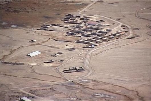
Prior to 2013 the India-China boundary saw only two incidents of serious importance post the 1962 war. They were at Nathu La in 1967 and Sumdrong Chu in 1986. Then in 2013, the Indian and Chinese armies stared each other down in Daulat Beg Oldi and a year later in Chumar. These high profile incidents were followed by the incident at Doklam at the India-China-Bhutan tri-junction in 2017. Simultaneously, another incident took place in Pangong Tso, Ladakh where in Indian and Chinese forces scuffled. When India converted Jammu & Kashmir and Ladakh into Union Territories in 2019 (described below), the Chinese perceived this as a threat to its claims on Eastern Ladakh. Subsequent face-offs occurred in Naku La in North Sikkim as well as in Ladakh.
Location: Western Himalayas, east of Jammu & Kashmir, administered by China and claimed by India
Name in Mandarin: 阿克赛钦 (ākèsài qīn)
Name in Hindi: अक्साई चिन
Surface area: 37,244 sq km (14,380 sq mi)
Terrain: high-altitude desert
Population: barely populated except by nomadic groups or Chinese military
Strategic importance: For India it is a gateway to central Asia, for China it connects Tibet and Xinjiang: whoever controls the area holds the key to invade the other side.
Pre-modern history: Because of its 5,000 metre (16,000 ft) elevation, the desolation of Aksai Chin lent it no importance other than seasonal trade route between Xinjiang and Tibet.
Pre-British Raj: Various vassals of Indic and Tibetan empires clashed, and withdrew borders which were never categorically demarcated, e.g. with the Treaty of Tingmosang around 1683 (Mughals-Ladakh-Tibet), and the 1842 Chushul treaty between vassals of the Sikhs (Dogras) and the Qing (Tibet).
British Raj era: The British were the first to attempt to demarcate this border, when no other powers were controlling the region. They invaded the region during Dungan Revolt (1862–77) and incorporated it into Kashmir which they conquered 20 years earlier.
Post Indian independence: From 1947, the government of India referred to the 1896 “Johnson Line” for its western boundary, which included Aksai Chin. During the 1950s, China built a road connecting Xinjiang and western Tibet which ran south of the line through Aksai Chin.
Aksai Chin is one of the two main disputed border areas between China and India (the other being Arunachal Pradesh). It is usually said to be “administered by China” (as part of Hotan County, in the south west of Hotan Prefecture of Xinjiang Autonomous Region). But it is more than only “administered”.
The People’s Republic of China proclaimed its independence on October 1, 1949. A year later, in October 1950, its army began the takeover of Tibet by the eastern provinces (Kham and Amdo) but also engaged troops from Xinjiang more accessible and already part of China since 1881. For such a move of troops, the only practicable and ancestral way through the massive massifs of Karakoram and Kunlun was by trespassing into the 160km length of the inhospitable area of Aksai-Chin (“The space of white stones” in the Uyghur language). In order to speed up its military movements, China even decided to make build a highway, without informing India. The Construction of this National Highway G219 commenced in 1951 and completed in 1957, and now links from Yecheng (Karghilik) in to Lhatse (TAR). It is indeed strategically important for China, not only as its runs along its 2,086 km south-western border, but also because it distances India from Lake Manasarovar and from the sources of the main rivers that irrigate it (Indus, Sutlej, Brahmaputra).
China is known to have a long memory and remembers when Kailash and the neighbouring country of Guge were seized in the 17th century by the Ladakhi king Sengge Namgyal, or when in 1841 a camp of 5,000 men under Colonel Basli Ram, settled in Taklakar, south of Mansarovar, to cover the flank of the Dogra army commanded by the famous Zorawar marching against Tibet. China also remembers that during the Tang Dynasty an imperial army led by a Korean general could progress up to Kashmir and Balistan, through Aksai Chin.
While the Indian military had informed the Nehru government from the start, a blind eye was tuned until 1958 when New Delhi finally decided to officially protest. China’s response was that Aksai-chin, (i.e. one fifth of the original Princely State of Jammu & Kashmir), belonged to her as part of ancient Empire, which it confirmed by the military argument, during the war she won in 1962 against India.
And as if this were not enough, in 1963, China was awarded the Raksam and Shaksgam valleys (also known as Trans-Karakoram Tract) by Islamabad, belonging to the “Northern Ladakh”, which is also part of the J&K State, conquered by Pakistan in 1947.
Whereas the border remains unsettled and a source of great geopolitical tension, India decided reshuffle the cards in August 2019.
Jammu & Kashmir was attached to India following the signing of the “Instrument of Accession” on 26 October 1947 by its last maharajah, Hari Singh, the Hindu ruler of India’s only predominantly Muslim state.
In a nutshell, just after the partition of 15 August 1947, the respective territories of Pakistan and India had not yet acquired their final perimeter. The British crown had indeed planned a subsequent procedure relating to the princely states of the Maharajahs (565 in total). The latter still had to opt freely either for their attachment to Pakistan or India, or for their independence.
The Maharajah Hari Singh decided to opt for independence and proposed to have it ratified by Pakistan and India. India gave an agreement in principle while Pakistan pretended to accept but soon put pressure to absorb Jammu & Kashmir. After a drastic economic blockade, Pakistan mobilised Pashtun tribal militias to take military control of the princely state in October 1947 on the grounds that its majority Muslim population could not be ruled by a Hindu. This triggered the first Indo-Pakistan war. An anecdote here is that the British army had not yet been able to carry out all the transfers of power from their general officers to Pakistan and India. These very British officers therefore led the clashes on both sides of the front in person, even losing one of their own in combat!
Finally the Maharajah Hari Singh opted for the aforementioned attachment to India, but in the non-negotiable conditions of the “Instrument of Accession”, providing for a unique status of autonomy which was endorsed by the British Crown and imposed on India. J&K was simply not subject to the Indian Federal Constitution except for military, monetary and some diplomatic affairs. For example, the border settlement of the region was excluded from full Indian federal sovereignty.
China and India did sign two international agreements, in 1993 and 1996, in order to establish protocols to resolve potential disputes in the region but had to do it in consultation with a J&K largely dependent on its trade with Pakistan, itself allied or even obliged to China, as is well known. These protocols included the mutual recognition of the “Line of Actual Control” (LAC), but disagreements continued between the two governments as to where the LAC lies precisely.
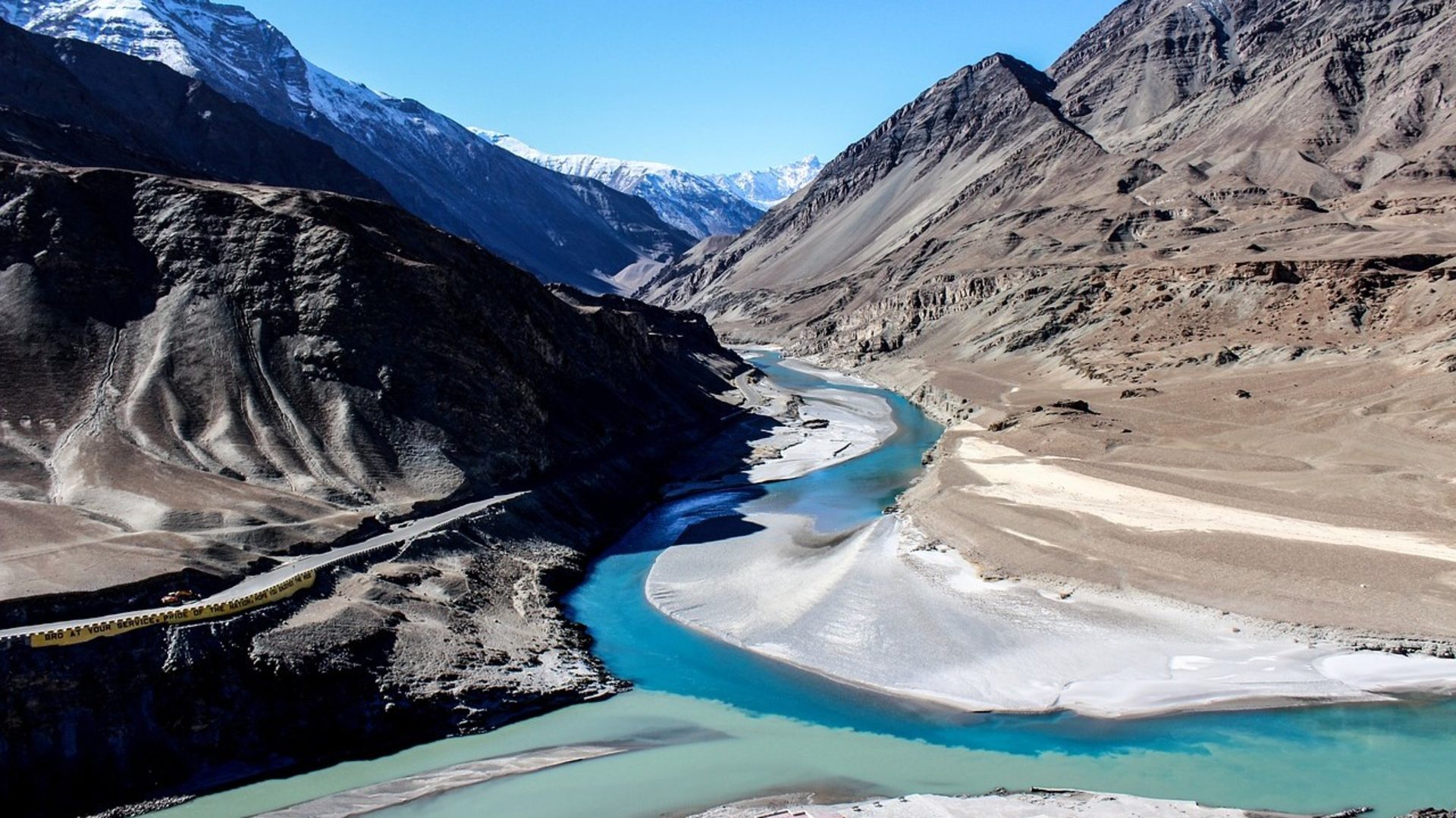
Being part of J&K, the partition of 15 August 1947 would leave Ladakh as a part of this new Indian state of J&K, to be administered from Srinagar. This is how Buddhist Ladakh had been caught within a local Muslim autonomous administration, strongly land-locked and under many rules, for instance forbidding the freedom of settlement even for Indian citizens, if they were not Kashmiris.
On top of this, China closed the ancestral trading routes used by Ladakhis:
i) In 1949, China closed the border between the Ldumra Valley (Nubra) that separates the Ladakh and Karakoram Ranges, blocking the 1000-year-old trade route from India to Central Asia.
ii) In 1962, China closed the Ladakh-Tibet border, ending the 700-year-old related relationship and obliging the Hindu and Buddhist pilgrims journeying to the most sacred Mount Kailash to bypass all of Nepal and Sikkim to the east, hoping that Nathu La pass would be open to them.
In the 2000s, following large-scale Chinese infrastructure improvements adjacent to the region, the Indian army began to develop the infrastructure on their side, which was perceived by the Chinese military as a threat. Chinese troops continued to enter the area hundreds of times per year, mostly without incident. In April 2013 a platoon-sized contingent of the People’s Liberation Army set up a camp set up camp 30 km south of Daulat Beg Oldi near the Aksai Chin-Ladakh LAC. The intrusion was not isolated, similar armed confrontations have occurred with increased frequency along the entire 4,000 km Sino-Indian border. During negotiations between China and India, the Chinese position was reinforced and supported by trucks and helicopters. As part of the resolution, the Indian military agreed to dismantle some military structures to the south that the Chinese perceived as threatening.
The ramifications of the Chinese advance into Ladakh are serious. As Indian nomads urbanise and migrate to cities, Chinese nomads encroach on India’s claim in the region. It has previously been presumed that in any final territorial negotiations, India may aim to exchange Aksai Chin for Tawang in Arunachal Pradesh, as Tawang has a large population settled and Aksai Chin had none. The settling of population in Aksai Chin may lead to a possible conclusion that the Chinese will continue to harden their stand and even claim Aksai Chin on settled population basis.
Beijing is adept at using a blend of threats and the promise of military retaliation to deter an adversary from taking actions contrary to China’s interests. Chinese leaders view the growing warmth in relations between India and U.S. with suspicion and the issue of China’s territorial disputes with neighbouring countries seem likely to ignite the flames of war sooner or later. If armed force is used to resolve its border disputes, India is a clear target.
In August 2019 the Modi government, the Indian President and both houses of parliament overwhelmingly took the historic decision to annul the special status of autonomy enjoyed by J&K. As of 31 October 2019, the state became a simple federal district, directly governed by New Delhi, even though a residual form of parliament is retained. Not only did it lose its own local jurisdiction and laws, but its area was further divided by two. Indeed, Ladakh’s Buddhists were simultaneously separated from J&K and came fully under the protection of the Indian federal constitution. Ladakh at first became “merely” a federal district directly governed by the Centre, but was also freed from all the previous constraints, in particular economic, with the full right of establishment and trade within the Indian Union, offering significant prospects for opening up. Finally, its new status allows India to directly address its border dispute with China.
To bring about this bold takeover, it was necessary to repeal Article 370 of the Indian Federal Constitution. However, this article covered, in law, the entire area of the original J&K, including the parts annexed by Pakistan and China. Home minister Amit Shah clearly asserted that such abrogation of article 370 includes PoK (Pakistan occupied Kashmir) and Aksai Chin as an integral part of India: “Kashmir is an integral part of India, there is no doubt over it. When I talk about Jammu & Kashmir, Pakistan occupied Kashmir and Aksai Chin are included in it,” he said.
This triggered the fury of Pakistan and the very explicit annoyance of China over the fact that internal legislation has spilled into territories claimed by these two other international nuclear powers, with no recognised external borders nor any peace treaty signed with India. Additionally, with a history of three wars having been triggered by Pakistan and its permanent jihad in place for 70 years, one war triggered by China, and incessant border skirmishes and intrusions since then: did they really think that such a situation, uncontrolled by India since Nehru’s times, would persist forever?
But Narendra Modi reshuffled the cards, with no prior notice. However, he did not choose the moment to do so by chance. He knew that the upcoming release of the “Afghan wasp”, negotiated between the U.S., Pakistan and the Taliban, will destabilise the region to the great satisfaction of Donald Trump, with a focus on the famous Sino-Pakistani economic corridor, which extends precisely along the G219 highway, crossing Aksai Chin.
India here has reminded anyone who is able to listen, that any reconfiguration in the balance of power balance will not happen without her, even if it means using Nuclear force. So yes, there is a risk of major conflict, but it is not India who is the primary inspiration. The message addresses both China and the United States. India clearly places herself as the arbiter of a new regional balance of forces, making it possible to avoid a very serious conflict, which is in the interest of China. But for that, Beijing will have to make some concessions, including territorial, otherwise India will be forced to play the American card.
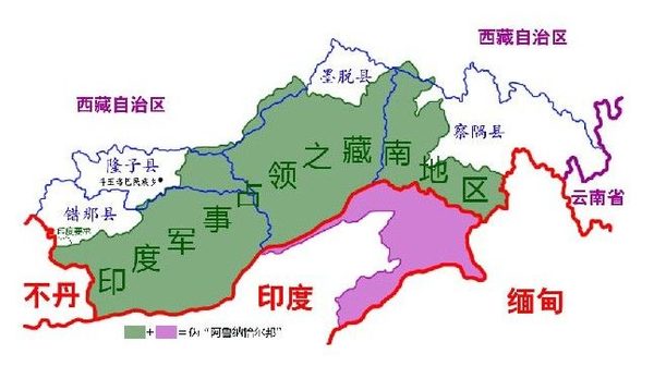
Location: Eastern Himalayas, bordering Bhutan and Myanmar, claimed by China and administered by India
Name in Mandarin: 藏南地區 (cáng nán dìqū); “Southern Tibet”
Name in Hindi: अरुणाचल प्रदेश
Surface area: 83,743 km2 (32,333 sq mi)
Terrain: Hilly tract nestled in Himalayan foothills
Population: 1.3 million
Strategic importance: Critical corridor between Lhasa and Assam, particularly Tawang situated at the tri-junction of India, Bhutan and Tibet.
Pre-modern history: unclear. Oral histories of Tibeto-Burman tribes point to Tibetan origins. Other indigenous groups align with Burma-area hill tribals. The region is referred to in Hindu texts.
Pre-British Raj: North western areas controlled by the Monyul Kingdom 500 BC to 600 AD, then under the loose control of Tibet and Bhutan. Remaining areas controlled by the Sutiya Kings until 16th century, then Ahoms of Assam until annexation by the British in 1858.
British Raj era: In practice most of its indigenous tribes remained autonomous until Indian independence in 1947. In 1914, following the Simla Accord, most of the state was ceded to Britain by the Tibetan government.
Post Indian independence: Referred to as NEFA (North-East Frontier Agency) from 1954, the border issue then re-emerged, leading to the Sino-Indian War of 1962.
Arunachal Pradesh (formerly called the North-East Frontier Agency (NEFA)) is one of the two main disputed border areas between China and India (the other being Aksai Chin), which in 1962 caused the two Asian giants to go to war. The unsettled border remains a source of great geopolitical tension. While the region is administered by India, China claims most of the state as “Southern Tibet”, It does not recognize the legality of the 1914 Simla Accord, a treaty defining the borders between Inner and Outer Tibet, and Tibet and British India: the much-maligned 550-mile “McMahon Line”.
Most of the state was ceded to the British Empire by the Tibetan government in 1914, including Tawang which borders Tibet and Bhutan, a critical corridor between Lhasa and the Assam Valley, of key military importance. While the Chinese did not dispute the border between British India and Outer Tibet, they refused to recognise the border between Outer and Inner Tibet. The Tibetan and British Governments proceeded without the consent of the Chinese, whose position was that Tibet was not independent from China. With the subsequent collapse of Chinese power in Tibet however, the line had no serious challenges. As Tibet had signed the accord, it was forgotten, until 1938 when the British published a bilateral accord, claiming Tawang as part of the NEFA.
The situation developed further as India became independent. In 1947 the Tibetan government wrote to the new Indian Ministry of External Affairs laying claim to Tawang. In 1950, with the newly established People’s Republic of China poised to take over Tibet, India unilaterally declared the McMahon Line to be the boundary and in 1951 after China’s annexation of Tibet, asserted its administrative control over Tawang. In 1962, during the Sino-Indian War, Chinese troops occupied Tawang for a time before withdrawing voluntarily, and the territory reverted to Indian control. However, China continues to claim Tawang as part of the Tibet Autonomous Region’s Cona County, and Tawang is the focal point of China’s obsession with the area.
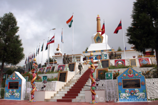
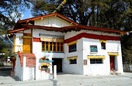
The Sixth Dalai Lama, Tsangyang Gyatso (1683–1706) hailed from Tawang, then in Monyul. In the Chinese contention this area, as well as Loyul and Lower Tsayul, were under Tibetan administrative control, and the Chinese authorities cite the Sixth Dalai Lama’s heritage to augment their claim to the region. The exiled Tibetan leader, the 14th Dalai Lama, has recognised Tawang as Indian territory and, to the anger of the Chinese authorities, visited it several times. Tawang houses one of several war memorials in the former NEFA battle zone. It is in the form of a traditional Buddhist monument which was inaugurated by the Dalai Lama in 1998. This bonding of the Indian Military with the Dalai Lama has great significance.
In 2013, Indian authorities were disturbed by Chinese military intrusions and infrastructure build up in Arunachal’s eastern sector occurring, so soon after the weeks-long intrusion in the Depsang Plains in Ladakh. While the number of intrusions along the Sino-Indian border had been steadily increasing in frequency, these coincided with intensified military activity along the Line of Control with Pakistan occupied Kashmir, signalling Beijing’s more assertive territorial policy. These actions followed the operationalisation of two major high-altitude airfields in Tibet, one opposite Ladakh and the other north of Arunachal Pradesh. The prolonged intrusions aimed to inhibit Indian activities near the border and test the Indian forces’ reaction capability, signalling that the border can be activated militarily at any time of Beijing’s choosing.
In 2015, the Indian government proposed to double the number of border police officers and an ambitious project to build a $6 billion road to run along the steep Himalayas from west to east. Indian authorities have also made efforts to to stem the flood of villagers migrating to big cities from the border.
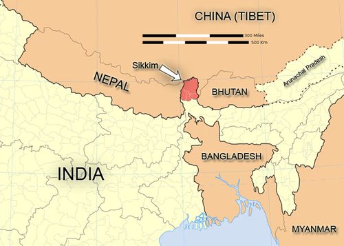
Map of north east India and bordering countries showing Sikkim (in red)
Since its establishment as a state in the 17th Century, the small Kingdom of Sikkim managed its geo-strategic sustainability as a “micro-buffer” between Indian, Nepalese, Bhutanese, Chinese, and later British interests. When the British Raj was established in 1858, its capital was Calcutta. The British feared an incursion by Russian forces, then on a march of conquest through central and east Asia since their victory against Napoleon. One of the corridors to necessary to succeed with such an incursion would be Sikkim, situated on a straight line directly south to Calcutta. The concern of British authorities was therefore to finalise control over this corridor which was unsettled since the time of the East India Company.
In fact the Sikkimese Kingdom never renounced its allegiances, either to Tibetan religious rulers or to the Chinese Manchu Emperors of the Qing Dynasty. In the late 1880s, the Tibetans felt confident enough to build a fortress in Lingtu (in the Nathang valley), 12 miles inside the Sikkimese border on the road to the Nathu La pass. By doing so, they alerted the British that if such an encroachment was possible from the Tibetans, it would also be so by Russian soldiers.
The urgent need by the British to control the whole area led to the Lingtu expedition of 1888, resulting in the Tibetans’ expulsion. This preceded the Anglo-Chinese convention of Calcutta two years later (1890) which established Tibet’s renunciation of suzerainty over Sikkim and delimited the border between Tibet and Sikkim. It is important to note that the Chinese empire was represented in this negotiation by its Amban (Political Officer) based in Lhasa, Tibet. By signing this agreement the British also secured their position against potential Russian designs in the region. Nevertheless Tibet’s claim over Sikkim was reiterated during the Simla Accord negotiations of 1913-14, but the British opposed it in accordance with their agreement with China.
As a consequence, the situation of Sikkim is different to that of the McMahon line. The Sikkim border question has been settled and signed by the Chinese, while the Simla Accord has not. Therefore from the Chinese point of view, while the McMahon line has no validity, they do recognise the approx. 200 km border of of Sikkim with Tibet. This reveals the confusion from the Indian side when in 2003 Sikkim was included in the “full package settlement” of the boundary question, instead of being kept separate. As such, India offered on a silver platter to the Chinese the capacity to renegotiate the borders of Sikkim, when before they had no claim. Nevertheless, the fact that the Chinese feel entitled to control the geopolitical status of Sikkim does remain a point of negotiation.
In 1965, three years after the Sino-Indian war, while India was occupied in a major conflict with Pakistan in the west, the People’s Liberation Army started to send probing missions throughout the entire Sikkim-Tibet border, and made several intrusions between September and December that year. India was ready and answered firmly. In October 1967 the PLA launched its 6-day war against India, trying to enter through the Nathu La and Cho La passes. Again, the Chinese were defeated to the extent that they complied, although not officially, with the terms of the unconditional ceasefire delivered by India. It is noteworthy that this occurred at the peak of China’s Cultural Revolution. Nathu La was sealed by India after the conflict.
In 1975 India annexed Sikkim and incorporated it as a state. This move was rejected by China up to 2003, when a Sino-Indian memorandum was hailed as a de-facto Chinese acceptance of the annexation. China published a map showing Sikkim as a part of India and its Foreign Ministry deleted it from the list of China’s “counties and regions”. Although China did not recognise the annexation by India, at the same time it did not refute the 1890 border agreement. Almost nothing happened until Deng Xiaoping rose to power in China. While apparently the Sikkimese question was settled, in fact it was not, because Sikkim was about to become a new laboratory for China’s soft power.
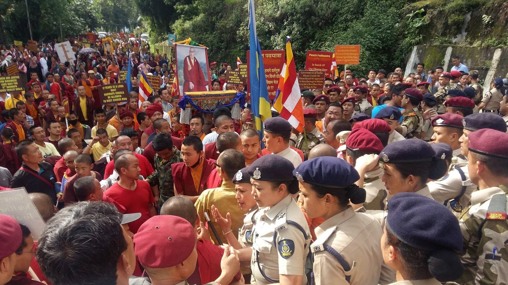
In 1981, a year before Deng took power, the patriarch of the powerful Kagyu sect of Tibetan Buddhism by the name of Karmapa Rangjung Rigpe Dorje, who had established his seat in exile in Sikkim, passed away. Under Deng, the Chinese government set to work to attract into its sphere of influence a handful of Tibetan leaders of this sect in order to take control over its future successor. Because of the opposition of another prominent leader of this sect, known as the Shamarpa, the Chinese plan found obstacles, to some extent.
In 1992 the Chinese regime appointed Rangjung Rigpe Dorje’s young successor, Karmapa Ogyen Trinley Dorje, as its official religious civil servant by acknowledging his recognition by the very Tibetan leaders they recruited a decade earlier (to understand why the Dalai Lama also agreed to this investiture, please refer here). Since then, two actions have been managed in parallel. On the one hand, agitprop within Sikkim mobilising for Ogyen Trinley Dorje to assume his predecessor’s Sikkimese seat (here, the objective is the control of Sikkimese hearts and minds). On the other hand, China has strengthened its military power behind the Sikkimese border at Nathu La, constructing an all-weather expressway and extending the Golmud-Lhasa Railway to Yadong, in order not to risk the same defeat as in 1967. These two complimentary strategic developments have matured in favour of Chinese interests toward control of the Siliguri Corridor, a narrow strip of land known as the “Chicken Neck” which separates India’s main land mass from its northeast states.
In short, China did not give up on Sikkim.
Joseph Kolmas “The McMahon Line: the further development of the disputed frontier” in Tibetan Studies in Honour of Hugh Richardson: Seminar Proceedings (Central Asian Studies), Aris and Suu Kyi (2012)
Sinister truth behind China’s border misadventure, Rediff (2009-09-18)
India Must Beware of the Chinese Dragon, Mainstream Weekly (2009-11-14)
Tibet and India’s Security: Himalayan Region, Refugees and Sino-Indian Relations, IDSA (2012-05)
The Untold Story: How Kennedy came to India’s aid in 1962, Rediff (2012-12-04)
China-India border talks pivot on Tibet, Asia Times (2013-04-22)
Indian Army matches China man-for-man on the border, Business Standard (2013-04-23)
Sikkim: Requiem for a Himalayan Kingdom, Andrew Duff (2015)
India, China can easily avoid border face-offs permanently, Defence Capital (2020-05-29)
The flight of the Karmapa and the security of South Asia, Taipei Times (2000-04-05)
China entered Sikkim during Ladakh face-off, Times of India (2014-10-02)
The State in the Colonial Periphery: A Study on Sikkim’s Relation with Great Britain, Rajiv Rai (2015)