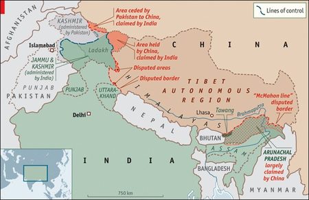
Himalayan region political borders and lines of control. (Source: Economist)
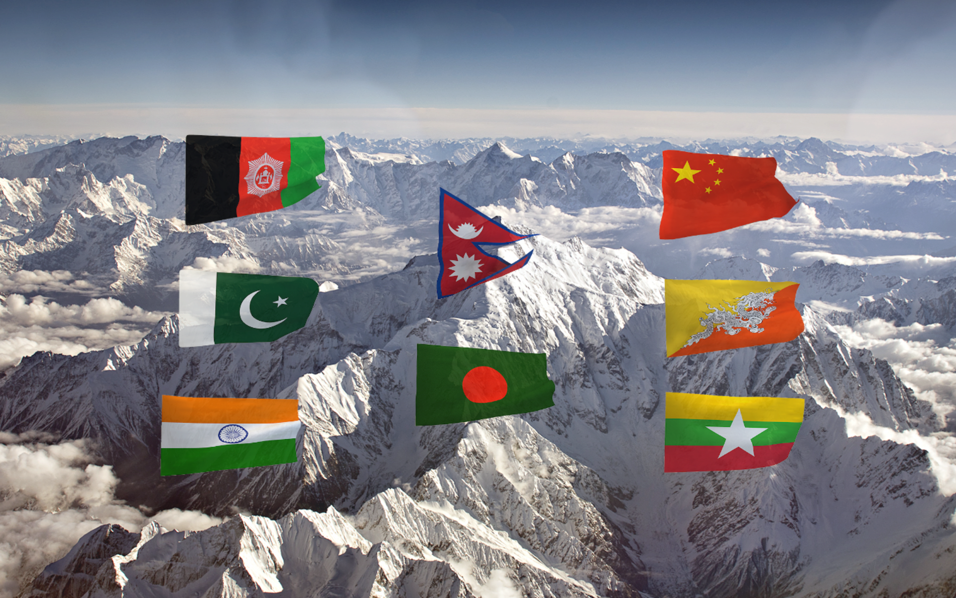
The Himalaya region extends 3,500 km over all or part of eight countries. The total estimated population of the region is 210 million. The 10 river basins which have their source in the region, provide water to 1.3 billion people, a fifth of the world’s population.
The Himalayas are well known as the highest mountain range in the world, including nine of the ten highest peaks, of which Mount Everest is the highest on Earth. Himalaya is a Sanskrit name, from himá (snow) + ā-laya, (dwelling), literally “abode of snow”. It is not a Chinese name, indicating that this majestic separation between the Indo-Gangetic Plain and the Tibetan Plateau holds a specific significance for Indian culture from time immemorial, but not for China – until it took control over the Tibetan plateau and its population. Even in the Chinese language this Sanskrit name is merely transliterated: 喜马拉雅 (Xǐmǎlāyǎ)
It is no surprise that many Himalayan peaks embody a sacred nature for Hindu, Buddhist, Jain and Bön followers, but of course not for those of Taoism and Confucianism. The most famous is Mount Kailash (from “Kelasa”, “crystal”) viewed as the throne of Lord Shiva by Hindus and the home of the deity Chakrasamvara by Buddhists, where every year countless pilgrims from neighbouring states (India, Nepal, Bhutan, Tibet) used to converge freely, with no Chinese visa, for thousands of years.
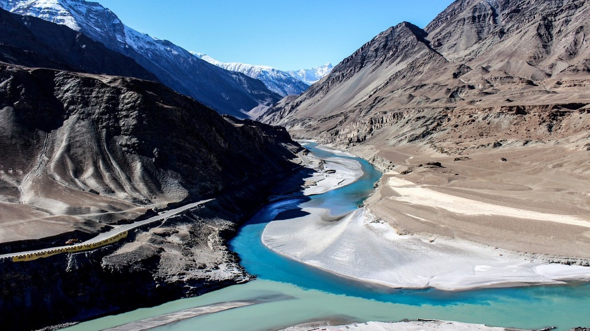
It is a fact that the region is cherished as a unique source of life as the origin of many sacred rivers, of which the Ganges (“swift-goer”), Indus (from “Sindhus”: “ethical”) and Brahmaputra (“son of Brahma”) are the most famous. However, it is now feared that such sacred water may become a major source of conflict between China and its southern neighbours, mainly India, due to China’s unchallenged control over it, e.g. via dams, diversion, and pollution.
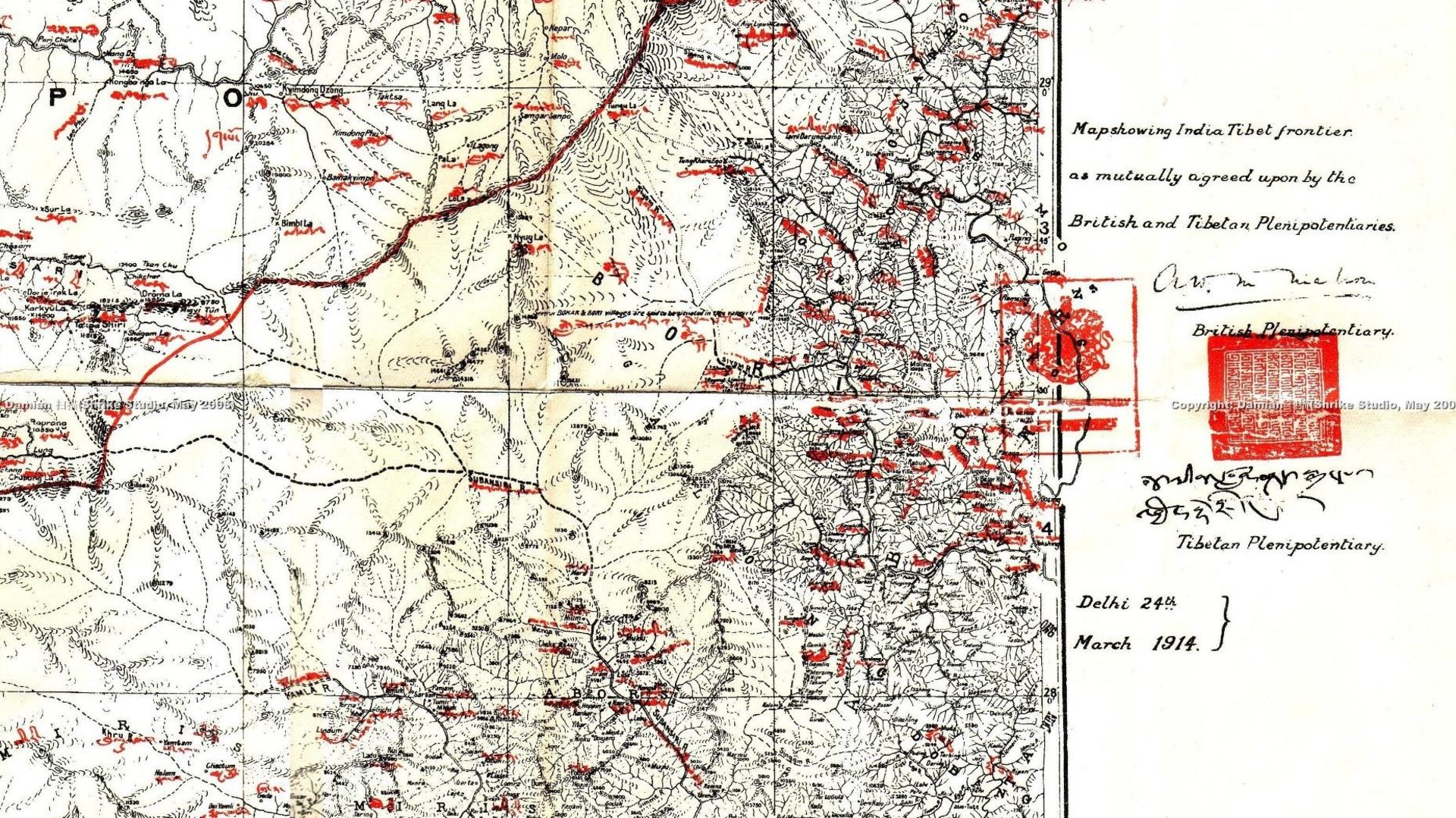
What is lesser known is that a war occurred between China and India in 1962 due to a complex border issue, through which China seized territories of the Aksai Chin and repeatedly encroached the borders of Sikkim, Bhutan and Arunachal Pradesh. It is even less well known that this war remains unsettled, with no peace treaty signed, leaving the world’s two most populous countries, both nuclear powers, in a perilous state of latent war.
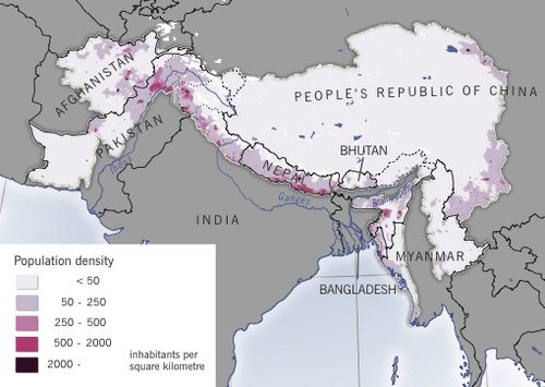
Population density in the Himalayan region (inhabitants per square km). (Source: GRID-Arendal)
Remarkably, adding to the already unique nature of this magnificent and sacred border, is that this state of war does not at present involve any direct permanent military presence of the major military powers (Western countries or Russia). In other words, it is the one and only open conflict zone in the world where the U.S. has not yet built up a single military base since World War II and where it has even preserved one country, Bhutan, from its official diplomatic presence (for the time being). Finally, with the exception of its extension into Kashmir, it is the only conflict zone where no UN or NATO “peacekeeping” forces have been sent. Besides its exceptional presence as the highest geological and spiritual mountain range, its huge geopolitical significance is that, since communist China took over the northern flank of the border, and in contrast to everywhere else in the world, the U.S., NATO and also Russian military powers haven’t yet found a way to establish a lasting presence.
Of course, Indian forces conduct exercises with those of friendly countries like the U.S., France, UK, Russia, Mongolia, Kazakhstan, Uzbekistan, Kyrgyzstan, Bangladesh, Myanmar, Nepal, Maldives, Seychelles, Singapore, Indonesia and Thailand, but nothing more. Nevertheless, times are changing with the recurring annual presence of U.S. troops nearing the Himalayas for regular drills.
Indeed, since 2002 the Pentagon has convinced New Delhi to set up Indo-U.S. combined military exercises, bringing American soldiers to the Himalayan foothills’ area of Chaubattia (Uttarakhand), equidistant (110 km) from the (western) border of Nepal and Chinese Tibet. As the U.S. Brig. Gen. Robert Ulses (deputy commanding general of support, 7th Infantry Division) put it in 2015, in typical jargon “This bilateral exercise reinforces our commitment to the Indo-Asia-Pacific region and improves the interoperability between our two Armies. It builds upon our enduring partnership and cultivates trust.” “Indo-Pacific” is the key term, also referred to as the “Pacific pivot”, meaning containment of China.
In other words, in the near future the military nature of the Himalayan border’s already unstable geo-strategic features may change due to the U.S.’s expertise in filling vacuums in and around any conflict zone on Earth. It is no surprise that such Indo-American training exercises have been baptised “Yudh Abhyas”, which translates: Training for War. Any implementation of a permanent U.S. military facility will indicate a shift from training to action.
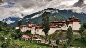
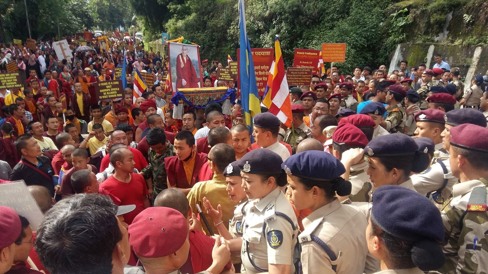
In the meantime, China builds up large roads, airports and railways along the border with India, extends its political influence in Nepal via its enduring Maoist clients, and penetrates Bhutan with the smiling help of seemingly harmless Chinese Buddhist monks, accredited by Beijing, and sponsoring huge and extremely costly religious monuments. Such religious soft power is now well established even inside India, particularly in relation to the state of Sikkim, south of which lies a strategic military bottleneck called the Siliguri Corridor, bearing in mind that China has never officially recognised Sikkim’s annexation by India in 1975.
On one hand India sees herself challenged by China by what she calls the “string of pearls” and has diversified her alliances and sources of military supply from Russia to include Israel, UK, France and above all the U.S., so much so that the U.S. has now overtaken Russia as India’s largest military equipment supplier. On the other hand, India has opened a religious Pandora’s box connected to a new generation of Buddhist organisations expanding throughout the Himalayas which play in favour of China. These target the Tibetan ethnic groups of the Himalayas’ southern flank, and their foreign supporters. While in Nepal China has controlled local power by playing the Marxist card, in the Himalayas more widely, it plays the Buddhist card, especially in Sikkim where a political shift favourable to China has already been seen.